Category Archives: bamta

BART’s Future Washington Metro-Style

This is a map I composed my Senior Year in high school, cleaned up and updated for posting on here. It details the potential future configuration of rapid transit in the Bay Area, including running Caltrain as a rapid transit service with an integrated fare structure. The graphic style invokes the classic Washington Metro map, where uniformity takes precedence over geographical accuracy and scale. A metro map, after all, is intended to help you get around the metro system, not drive around the area. I hope you will find this map as enjoyable to view as it was for me to create.

Wilshire & Geary: Two Streets and Two Subway Projects

Like many other things, California was the birthplace of modern rail transit in the United States. BART in the San Francisco Bay Area was the first complete, publicly built, rapid transit system in the United States and represented a paradigm shift in the mentality of transit planners. BART ran from the Outer East Bay (Fremont and Concord) to San Francisco and Oakland’s Downtowns. The line to San Francisco is a branch, and the system is rooted in Oakland. This stands in stark contrast to the New York City Subway or Chicago L, which serve the center city extensively and end in the inner suburbs. These cities have heavy rail, diesel commuter systems which use existing freight tracks without grade separation.

The Bay Area got BART instead of a traditional commuter rail system because of politics. President Lyndon B. Johnson was supporting his Great Society idea, injecting a large amount of public spending for grand, shiny projects like heavy rail systems. Diesel locomotives, or even traditional electric locomotives used on the Northeast Corridor, simply were not as cool. Now, the problem when the “cool” factor gets into transit planning is cost. BART continues to expand at the insane cost of 200+ million dollars per mile. More significantly, BART is the only heavy rail (subway) technology that is feasible to build in Northern California due potential to connect to the current network. BART’s trains are over 700 feet long, with far too many seats and too few doors for urban service.

Los Angeles has a heavy rail service also, but it is entirely different than BART. Los Angeles’ Subway, the Red and Purple Lines, only serve the City of Los Angeles and they travel the most dense areas in all of Los Angeles County. This distinction is easy to see in ridership per mile, where Los Angeles has about 9,000 riders per mile, while BART has 4,000. Train lengths in the LA Subway are 450 feet, and cars have three doors and far fewer seats than a BART train. This is the type of true subway both Los Angeles and San Francisco Need.

The purpose of this article is to compare and contrast two streets in two big, dense cities, that both need heavy rail subway lines under them. Also, I will go into the reasons why one of these subways will be built in the next ten years, and the other won’t.

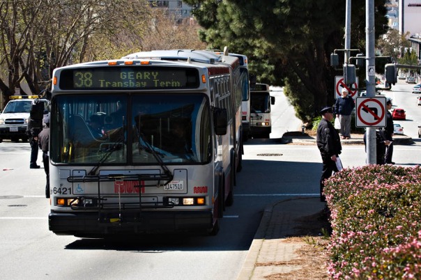
These two streets are Geary and Wilshire Boulevards in San Francisco and Los Angeles, respectively. Both streets carry the two busiest bus lines in the United States, the 38-38L in San Francisco and the 20-720-920 in Los Angeles. These lines carry over 60,000 passengers a day, a huge amount for a bus line. Metro cannot physically run more buses on Wilshire during peak hour because of intense bunching. Both of these transportation corridors are East-West with parallel bus service also carrying over 100,000 passengers a day on the 1-2-5-31 in San Francisco and the 2-4-14-16-316-704-714 in Los Angeles. Obviously transit demand in these corridors is huge.

The legacy of BART and the Red Line have dictated the progress on high capacity transit alternatives on Wilshire and Geary. Both Metro and SFMTA are implementing exclusive bus lanes on these streets. In neither situation are exclusive lanes sufficient. Underground, high frequency, heavy rail transit is sorely needed in both situations. Since Los Angeles began with a legitimate urban subway system, instead of a suburb-centric heavy rail system, extension along Wilshire Boulevard is (relatively) cheap and feasible. Under Measure R’s schedule, the Westside Subway Extension will reach Westwood by 2036, although with the 30/10 plan, the entire project may be complete 15 years earlier.

This situation leaves us with Geary Boulevard in desperate need of heavy rail transit. The organization of the BART District, with equal power shared across Alameda, Contra Costa and San Francisco Counties, essentially requires equal geographic distribution of BART dollars and extensions. When Contra Costa County got the extension from Concord to Pittsburg/Bay Point, Alameda County got the extension from Bay Fair to Dublin/Pleasanton. San Francisco essentially gained nothing during this time, but that is due to Proposition K, San Francisco’s transportation sales tax, not including any funding for BART extensions. In a new round of extending BART, Alameda County is getting the Warm Springs Extension, and potentially BART to Livermore, while Contra Costa County is getting eBART. Again, San Francisco County is doing its own thing with the Central Subway, Van Ness and Geary BRT and the Transbay Transit Center Program receiving the bulk of the funding.

The essence of the issue with a Geary Boulevard subway is it requires a New Transbay Tube, a mega project on the scale of East Side Access and Access to the Region’s Core Projects in New York City, with a cost that could exceed 6 billion dollars. The issue for BART and the Bay Area is finding a sustainable funding model for this huge project, in my opinion a three way split between San Francisco, Alameda and Contra Costa, so that San Francisco has a platform on which to build its new heavy rail service to the Richmond District.

Maybe, after enough pushing, BART will become more of an urban network, with higher stop frequency in Oakland, Berkeley and San Francisco, and large transit villages outside the urban core.

What BART Should Look Like in 2030.

The San Francisco Bay Area is an interesting transportation case study because of its geography. Several mountain ranges and a large body of water present challenges in building new infrastructure and often create bottlenecks on bridges and tunnels. Such a situation increases the attractiveness of high capacity transit. Luckily, the Bay Area has BART, the first of the modern heavy rail systems built in the United States. In areas where BART parallels a congested bottleneck freeway, such as the  Transbay Tube and Berkeley Hills Tunnel, ridership is high. Unfortunately, because BART was the first of its kind, a modern system designed to be compatible with driving, BART does not work as well as other systems of the same age, especially the Washington Metro in DC. In this post, I’d like to address the reasons why BART does not work well as an urban transit system and how in 20 years with a large investment BART can grow into a true Metro system for the San Francisco Bay Area.

Two main issues plague BART’s ascension to a great rail transit system. The first is a lack of political backing for transit oriented development (TOD) near BART stations. The second is the actual design of the system, especially the large distances between stations and choices of right of way for several lines. For the purpose of this article, I am going to refer to the lines by color even though BART lines are commonly named by their terminus.

Transit Oriented Development is essential to the success of any rail transit project. The availability of frequent, quick service to employment centers allows dense housing and retail development within 1/4 of a mile of a rail station, while drastically reducing the amount of parking needed. BART has two TOD projects that have already opened, Fruitvale Village in Oakland and a project at the Pleasant Hill Station. Both are mostly housing, ignoring the need for grocery stores, dry cleaners and other essential services, and are not as high density as TOD in other parts of the country. BART has no excuse to not further promote TOD around its stations. BART owns surface parking around many of its stations and could easily sell the land to developers to build large, dense projects. Local government has been getting in the way of this density. A classic NIMBY (not in my backyard) argument against density increases is that density increases crime, traffic and noise. All three are mitigated by proximity to frequent rail transit. Stations like North Berkeley and Orinda being surrounded by single family detached homes and surface parking are detrimental for ridership numbers and waste the investment of rail transit. BART must encourage local governments to allow more dense development and provide land for developers on which to build.

More importantly, the design of BART’s first 104 miles is conducive to suburb to downtown commuting and largely ignores the needs of urban riders in San Francisco, Oakland and Berkeley. Long distances between station, especially in Oakland, and the routing of four routes onto a single San Francisco subway line limit ridership and utility to the huge pool of potential riders in the most urban areas of the Bay Area. One immediate solution is the construction of infill stations. On the map above, I have detailed several infill stations that could attract a large number of riders. On the Red Line I suggest building an station at Solano Avenue in Albany and a station at 58th Street in North Oakland. For the Green Line I’ve added infill stations at 15th Avenue in Oakland, at 54th Avenue in Oakland, and at 98th Avenue in Oakland. All three will serve people without access to an automobile and dramatically increase ridership along this portion of BART. On the Yellow I included an infill station at Oak Grove Road in Concord and a station at 30th Street and Mission Street in San Francisco. Feasibility studies have already been conducted on this 30th/Mission Station and construction could start soon if the 700 million dollar cost was allocated. Also, studies have stated that a 30th/Mission Station would be an ideal short turn station for the Green Line, hence its termination there on my map.

Part of the issue with BART is capacity in the Transbay Tube. BART’s automatic train control (ATC) can only handle a frequency of 27 trains per hour (a train every 2 minutes and 13 seconds). BART already runs this frequency during the peak hour in the peak direction. This limitation also reduces frequency on outer branches of the system to 4 trains per hour (a train every 15 minutes), even during rush hour when demand is highest. This limitation will become a huge issue if opportunities for TOD are explored further and reverse peak and suburb to suburb commuting become more common on BART. I propose a dramatic, expensive, but necessary solution. Build a second Transbay Tube.

A second tube could include Oakland Wye (the main switch between BART lines) bypass track segments that serve important destinations in the East Bay. The Red Line could split immediately after MacArthur Station to an underground Emeryville Station then follow the Union Pacific right of way to the new tube’s portal. The Blue Line could split after the new San Antonio Station and travel along the Union Pacific right of way, dipping into subway for a Jack London Square Station, then emerging to join the Red Line and cross under the bay. Once in San Francisco, this line would stop at the new Transbay Transit center then follow Geary Boulevard all the way out to the Richmond District. This corridor’s bus ridership easily merits heavy rail transit with over 200,000 bus riders on and near Geary. This Geary route conforms with the general consensus of transportation planners regarding the routing of a second BART line through San Francisco. Around 18th Avenue, the Red Line would diverge from Geary Boulevard and travel south under 19th Avenue, serving the Sunset District and San Francisco State University. Just before the Daly City Station, the Red Line would rejoin the Yellow Line and continue along its current route through San Mateo County to Millbrae Station. A beachside terminal for the Blue Line would allow a shorter route for the line and complete the entire length of Geary Boulevard, from bay to breakers. Such a proposal is dramatic not only because of its cost (likely 8 billion dollars or more) but because I estimate that over 300,000 riders would use this new tube and urban subway, nearly doubling BART’s ridership.

Finally, I have added three suburban extensions of current lines on my map. The Green Line extension to San Jose is already under construction to Warm Springs and Santa Clara County has sales tax revenue to cover the rest of the line. An extension of the Blue Line to Livermore is under serious study right now, and I’ve included alternative 2a from the planning process, BART along I-580 then a short cut and cover subway to Downtown Livermore where a new intermodal terminal with ACE commuter rail service would be built. The Red Line extension on my map has not yet been studied nor is funded in any way, but completes a deficiency in the BART network by connecting Northwest Contra Costa County to the rest of the Bay Area. These suburban extensions would fill out BART and, with adequate policy, encourage transit oriented development around stations. The increased frequency of trains on outer branches due to the second Transbay Tube would allow for more opportunities in density growth around these new stations.

The San Francisco Bay Area is lucky to have BART, but a large injection of capital and a change in priority could change the system from a commuter rail-like operation to a true urban rapid transit system. If you want a more geographically accurate map of my 2030 BART plan look at the bottom of the article. Again, stay tuned for my post on the politics of transportation in Los Angeles.

The Bay Area’s Fragmented Transit Operators

In the United States, public transit as a mode of travel is generally slower and less convenient than driving. Sixty years of automobile-oriented development and massive subsidies for freeways, parking and fossil fuels have made driving the predominant mode of transportation. Programs like the Federal Transit Administration’s New Starts  have made transit more viable for many, but the operational and funding structures of transit agencies often further complicate trips on transit.

The San Francisco Bay Area is the most fragmented transit market in the country. With a population of nine million and very dense development concentrated in linear patterns due to geography, the Bay Area should be a great place for transit. Rail ridership on all systems is around 600,000 per day and bus ridership on all systems is around 1.5 million riders per day. Those numbers are impressive, but the fragmentation of transit operators greatly inhibits longer trips, causes cutthroat competition for funding and is grossly inefficient for capital expenditures.

Take for example Contra Costa County in the East Bay. Four bus agencies, AC Transit, County Connection, WestCAT and Tri-Delta Transit cover the largely suburban county, all of which but AC Transit provide very infrequent service and serve a small amount of riders. Their limited service areas and low budgets limit the potential for more regional routes. For example, a rider in Hercules traveling to UC Berkeley would need to take a WestCAT bus that runs once an hour to El Cerrito Del Norte BART, take BART to Downtown Berkeley then take AC Transit 51A to campus. This trip would take over one hour by transit, cost nearly six dollars each way and only be possible once an hour. Merging transit agencies could coordinate schedules, cross subsidize suburban bus service with urban bus or rail revenue and consolidate administrative and purchasing departments to cut costs.

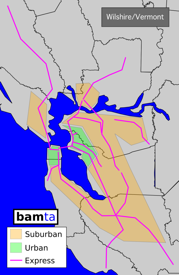
A “super” transit agency for the Bay Area would look something like New York’s MTA or Chicago’s RTA. In this hypothetical situation, let’s call the agency bamta (Bay Area Metropolitan Transportation Agency). bamta would absorb the core portions of AC Transit (Oakland-Berkeley-Richmond) and all of SF Muni’s bus operations into bamta Urban Bus Division. Suburban portions of AC Transit (in the Fremont area), WestCAT, Tri-Delta Transit, Vallejo Transit, County Connection, WHEELS, Marin Transit Local Service, SamTrans and VTA would all become bamta Suburban Bus Division. Finally AC Transit Transbay Service, Golden Gate Transit, Baylink, Dumbarton Express and all express routes of WestCAT, SamTrans and VTA would become bamta Express Bus Division. This substantial consolidation would centralize planning, coordinate route schedules, provide service across current service boundary lines and allow collective bus purchases to cut costs.

Rail operations in the Bay Area are also managed by far too many agencies with diverging goals and incompatible scheduling. An electrified Caltrain and BART could be combined into bamta Rapid Transit Division. SF Muni’s Metro System and VTA light rail could be merged into bamta Light Rail Division. Finally, ACE, SMART, Capitol Corridor and Caltrain diesel operations could become bamta Commuter Rail Division.

bamta could also gain control of the Bay Area’s numerous toll bridges and directly use revenues for transit operations. The Golden Gate Bridge Highway and Transportation District and Bay Area Toll Authority would combine into bamta Highways and Bridges.

Under such a drastic plan, the Bay Area’s current (and ineffective) metropolitan planning organization, MTC, would no longer be needed and could be disbanded. bamta would assume MTC’s duties as MPO. bamta would also assume BART’s previous role as a special district, giving it the ability to tax the nine counties in which it would operate.

With a dedicated source of funding, in the form of a sales or payroll tax, current disasters like the 61 million dollar budget deficit at Caltrain would be avoided. Transit through bamta would be more convenient and coordinated, funding would be directed at a single body instead of over 15 agencies and administration could be consolidated. Think of it: instead of 15 Human Relations Departments or 15 Legal Departments, there would only be one and so on.

Less competing government agencies, a more streamlined approach to transit planning and operations and a unified brand for transit in the Bay Area would vastly improve transit’s ability to compete with the automobile. Politically, this agency would hold clout equal to the Los Angeles County Metropolitan Transportation Authority in statewide matters of transportation funding, giving Bay Area residents a heavier hand in State politics.

You will hear more of my bamta idea in posts to come, especially about a unified rail system and its benefits. I’ll also finally get to my third post about the Los Angeles Westside Subway Extension tomorrow.

Politics and the follies of the California State Government will likely prevent any consolidation of transit agencies, let alone one as drastic as my proposal. Alas, one can dream.